[updates follow original entry; latest as of 7:30 pm EDT Wednesday]
Finally able to catch a breath and post an entry in the midst of getting busy with Dolly; after a plateau on Monday, the storm's spin increased to hurricane intensity on Tuesday and is on a beeline toward the coast of South Texas and extreme northern Mexico.
This is about as wild-looking a satellite image as you're going to see of a weak tropical storm, as Dolly was Monday evening.

Although it looks like the storm was massive in size, much of what you see was just innocuous clouds.
Twenty-four hours later, and the satellite image is still a bit misleading.

Dolly is stronger now, having become a hurricane, and it's not nearly as small in size as Humberto was when it was in the western Gulf last year.
However, while there are some thunderstorms hundreds of miles north and northeast of the center, all of the strong winds directly associated with the hurricane are confined to the inner core of the hurricane, represented by the darkest reds on the satellite image above to the southeast of Brownsville and the swirl of colors on the radar image (which is much different in character than the appearance of Cristobal on radar while approaching North Carolina a few days ago).

The center of the hurricane is headed toward a landfall on Wednesday not far from the U.S/Mexico border. The exact time will depend on the degree to which Dolly continues slowing down, but regardless conditions will deteriorate overnight as that stuff on radar reaches the coast, well ahead of the arrival of the center.
We'll have to keep a close eye on the intensity overnight. The latest aircraft recon measured a central pressure of 982 millibars, or exactly 29 inches of mercury, but did not find winds as strong as sometimes is the case with a pressure that low. We'll have to see whether the winds "catch up," although fortunately the hurricane is close enough to the coast that time will run out for strengthening before too much longer.
Even if the hurricane continues intensifying, barring something shocking happening its winds will still be a far cry from those of hurricanes such as Category 5 Andrew in 1992 or Category 4 Charley in 2004, both of which hit South Florida, and both of which produced severe direct structural damage, destroying many buildings.
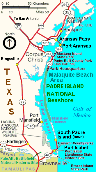
Nevertheless, although Brownsville has been brushed in recent years, the center of a tropical storm or hurricane hasn't passed within 25 miles of the city since Allen in 1980, and if Dolly's center doesn't do that it's not gonna miss by much. Thus, folks in the greater Brownsville area should be prepared for stronger winds than they usually see, and those winds will be capable of downing trees, causing power outages, etc.
The coastal surge won't be anything like that of Katrina, but expect several feet of water level rise along with high surf on top of that.
Then there's the rainfall, the magnitude of which won't be dependent on whether the hurricane's wind velocity increases. After landfall Dolly will be moving slowly, leading to a persistence of torrential downpours. In extreme southern Texas, although the wet system a couple of weeks ago alleviated the drought, more moisture is needed, but not so much so quickly that flooding or flash flooding occurs.
The Brownsville office of the National Weather Service noted in one of their analyses on Tuesdsay:
WORTH MENTIONING THAT WITH THE INCREASING CONFIDENCE IN A WIDESPREAD HEAVY RAIN EVENT... BROWNSVILLE HARLINGEN AND MCALLEN ARE IN JEOPARDY OF SHATTERING ALL TIME JULY TOTALS. THE FOLLOWING ARE CURRENT TOTALS AND THE VALUES NEEDED TO BREAK THE ALL TIME RECORD:
BROWNSVILLE.....6.22 SO FAR 3.22 NEEDED TO BREAK JULY RECORD
HARLINGEN.......6.18 SO FAR 2.47 NEEDED TO BREAK JULY RECORD
MCALLEN/MILLER..4.97 SO FAR 5.01 NEEDED TO BREAK JULY RECORD
And the prospect of another deluge is decidely unwelcome in the Mexico state of Tamaulipas, just south of the border, where the flood disaster occurred earlier this month.
UPDATE 7 AM EDT WEDNESDAY JULY 23
Good news and bad news this morning. The good news is that Dolly's intensity didn't do anything drastic overnight and it's rapidly running out of time. The bad news is that the hurricane didn't weaken either, in fact it continued to get better organized and strengthen slowly.
The inner core of the hurricane is pushing onshore, and the eyewall, which contains the strongest winds, is not far offshore. That eyewall has had a particularly dramatic appearance on radar, with its curved line segments rotating around the center like spokes on a wheel.

UPDATE 9:45 AM EDT
The central pressure has dropped to at least 967 millibars, with 964 "extrapolated" from about 10,000 feet.
The significance of all that is that a pressure in the mid 960s is typical of a hurricane well into the Category 2 range, even getting close to Category 3. In this case the aircraft wind measurements have been lagging behind what one might expect given the pressure, but the steadily dropping pressure and much more well-organized appearance on satellite imagery indicate that the hurricane continues to crank up.
The increased wind means that not only will trees and power lines come down (already there are outages being reported), but direct structural damage will also occur, especiallly to less sturdy buildings. Jim Cantore, reporting from South Padre Island, just showed how the water level has receded where he is, but that's because there's temporarily an offshore wind at that location -- the surge is still coming.
As I noted above it's been a long time since this area has had a direct hit by a strong tropical cyclone, and with the western eyewall within 10 miles of the coast it's time to batten down the hatches ... and with the slow movement of the hurricane, the roughest weather is going to take quite awhile to work its way through ...

UPDATE 12:15PM EDT WEDNESDAY
The National Hurricane Center did bump the intensity up to Category 2 in their latest advisory. The center is moving painfully slowly, so it hasn't made landfall yet, and it has also wobbled a bit north.
As I wrote about during Hurricane Dean last year, sometimes little wobbles matter, and that's the case today, for example if the eyewall (which contains the strongest winds) were to miss Brownsville and hit mainly unpopulated areas to the northeast. Also, a northward jog would reduce the surge on South Padre Island where Jim Cantore is and instead bring it onto the National Seashore. The steering currents are weak at the moment so it's a matter of tracking the center closely minute by minute.
Even with the center wobbling a little farther north, we're starting to get reports like these in from around the region:
1104 AM SOUTH PADRE ISLAND
ALL POWER OUT TO ISLAND. DAMAGE TO CONDOS.
1104 AM PORT ISABEL
POWER LINES DOWN. SCATTERED FLOODING.
1104 AM HARLINGEN
POWER POLES BLOWN DOWN ON BUILDINGS.
1104 AM BROWNSVILLE
POWER LINES DOWN. SCATTERED FLOODING. DEBRIS ON ROADWAYS.

UPDATE 6:30 PM EDT WED
Well, it's been quite a long day for folks in extreme southern Texas, as Dolly intensified and made landfall as a borderline Category 2, and has been slooowly moving across the region, and it's not close to being over yet.
Here's a 3-D and cross-section look at the eye and eyewall around the time of landfall, followed by a conventional radar image shortly prior to landfall of the southwest eyewall which erupted over South Padre Island.


Source of images: GRLevelX
Tropical cyclones get energy from the warm water over which they form, and weaken upon moving inland, some at different rates than others. More so than with some, Dolly is still having quite an impact hours after landfall, because it's moving slowly; it was a solid hurricane at landfall, near peak intensity; it's not small in size; and its landfall on the mainland was awhile after its official landfall on a skinny barrier island, and that mainland is flat and low-lying.
In fact, at this hour (5pm CDT), more than three hours after landfall, the center of Dolly is only about 20 miles from the landfall point on the barrier island and only 10 miles inland from Laguna Madre the bay separating the barrier island from the mainland.
The southwest eyewall which flared up while over South Padre Island, from where TWC's Jim Cantore and Julie Martin have been reporting, is still very potent for both wind and rain as can be seen on the recent radar image below, and there are communities north of Brownsville in its path which are still getting hit very hard by both. As is the case with tornadoes, it is likely that it'll take awhile for complete information to be received on what the impacts have been.

In regard to weather observations, we are getting none from Harlingen, because there appears to have been an instrument failure. This was the last ob, from 2:19 pm EDT with the wind "MMMM" (direction and speed both missing):
HRL SP 1919 AO2A 73/73/MMMM/923/ RAEMM PRESFR $ PCPN 0070=
But we have started getting reports of flooding there:
...SEVERE FLOODING REPORTED IN HARLINGEN...
HEAVY AND PERSISTENT SHOWERS...ASSOCIATED WITH THE EYE OF WEAKENING HURRICANE DOLLY...ARE CAUSING MAJOR FLOODING IN THE CITY OF HARLINGEN THIS EVENING.
A TEXAS STATE OFFICIAL REPORTED TWO FEET OF WATER IN PORTIONS OF DOWNTOWN HARLINGEN...WITH WATER IN HOMES IN THE JACKSON STREET AREA. THE HARLINGEN POLICE DEPARTMENT REPORTED FLOODING ON POLK... TAYLOR...PIERCE...FILMORE...AND COMMERCE.
A long day, and it's gonna be a long night. Eventually the wind will start abating below levels capable of causing widespread problems, but the locally heavy rainfall and a flood threat will continue into Thursday, including in areas just south of the border which escaped the strongest winds today.
UPDATE 7:30 PM EDT WED
During the past hour, there was another weird radar image produced by Dolly. "Spokes" in the eye are not uncommon as observed on visible satellite imagery and sometimes on radar, but this was a particularly distinct, straight-line one bisecting the eye as it spun around:

Meanwhile, I looked at the historical data for some perspective on other U.S. hurricanes that had landfall pressures of millibars in the 960s or so (approximately 28 1/2 inches of mercury). In general, the lower the central pressure of a tropical cyclone, the stronger its winds are.
Although it's possible this will be changed in the official postseason report, the central pressure listed in the NHC advisory prior to and shortly after landfall of Dolly was 967millibars.
Here are the other hurricanes with a U.S. landfall or a direct hit (i.e. center stayed just offshore, indicated by **) since 1950, which had pressures at landfall of 960 -- 970 millibars:
970 David (1979 -- GA/FL) Cat 2
968 Cleo (1964 -- Florida) Cat 2
967 Kate (1985 -- Fla. Panhandle) Cat 2
967 Dolly (2008 -- TX) Cat 2
966 Dora (1964 -- Florida) Cat 2
964 Bonnie (1998 -- NC) Cat 2
964 Georges (1998 -- MS) Cat 2
963 Lili (2002 -- Louisiana) Cat 1
962 Connie (1955 -- NC) Cat 3
962 Alicia (1983 -- Texas) Cat 3
962 Bob (1991 -- New England) Cat 2
960 Carol (1954 -- Northeast) Cat 3
960 Ione (1955 -- NC) Cat 3
960 Emily (1993 -- NC**) Cat 2
960 Frances (2004 -- FL) Cat 2
No comments:
Post a Comment