[update follows original entry]
Well, almost, but not quite yet. Bertha has been resilient to hostile atmospheric forces in its environment (dry air and "shear"). After looking sick yesterday, the hurricane has become better organized again last night and this (Wednesday) morning.
[Source: Naval Research Laboratory; I've circled Bermuda]

And although its core may ultimately not hit any land areas, the steering currents are going to get more nebulous with time, which means there's uncertainty in the details of the outcome. Note the key word: details. In the big picture there's a high confidence of what's going to happen.
The hurricane is not a direct threat to North America (and although there were was some sensationalistic stuff out there on the web, that was a long shot at best.). Indirectly, it'll generate waves which will head toward the East Coast.
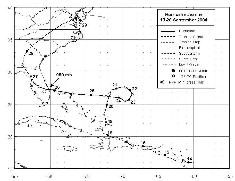
Eventually, Bertha is expected to head out to sea. Sometimes when tropical cyclones meander out in the Atlantic, the meteorological players can evolve in such a way as to, lo and behold, suddenly cause them to make a beeline toward North America. Jeanne's track in 2004 was a classic example of that.
[Source: National Hurricane Center; click on image for larger version]
However, rather than a ridge of high pressure building to the north and northwest of Bertha like was the case with Jeanne, a trough of low pressure will develop in the western North Atlantic this weekend and early next week, which will prevent any additional westward movement.
Before that happens and Bertha goes completely bye-bye, though, it could move painfully slowly for awhile, and exactly where it is at the time and how much it expands in size will determine the effects in Bermuda, and whether the islands just receive waves and perhaps some outer fringes of wind/rain, or more substantial and prolonged wind/rain. It's gonna take a number of days for this to play out, but right now the former is more likely than the latter.
UPDATE 4PM EDT WEDNESDAY JULY 9
Although somebody posted a comment suggesting that maybe Arctic ice cooled the water and killed Bertha, actually water temperatures in most of the North Atlantic are running above average, and the hurricane weakened yesterday while moving over increasingly warm water. And now, rather than being killed, it's making a big comeback, increasing again in both intensity and size.

It's not moving any farther west than expected, though, so the scenario for Bermuda remains unchanged.
No comments:
Post a Comment