... well, not quite 2005. We're fortunately already falling behind that pace -- by now there had been the "E" storm as well as two major (Category 3+) hurricane landfalls, Emily in Mexico on this date and Dennis the week before in Cuba and the U.S -- but the tropical atmosphere is otherwise about as stoked as it ever gets at this point in the season.

On the satellite image (click on it for a much larger version), there is, at the time of this posting:
(1) Yet another well-organized low emerging off the coast of Africa.
(2) Bertha, still a tropical storm and continuing to set July records.
(3) A low spinning offshore just northeast of Jacksonville, Florida.
(4) A disturbance in the eastern Caribbean which keeps waxing and waning but can't yet be written off as it heads in the general direction of the Yucatan and Gulf of Mexico.
(5) A disturbance bringing locally heavy rain to Central America.
And, in the eastern Pacific:
(6) Tropical Storm Fausto.
(7) Hurricane Elida.
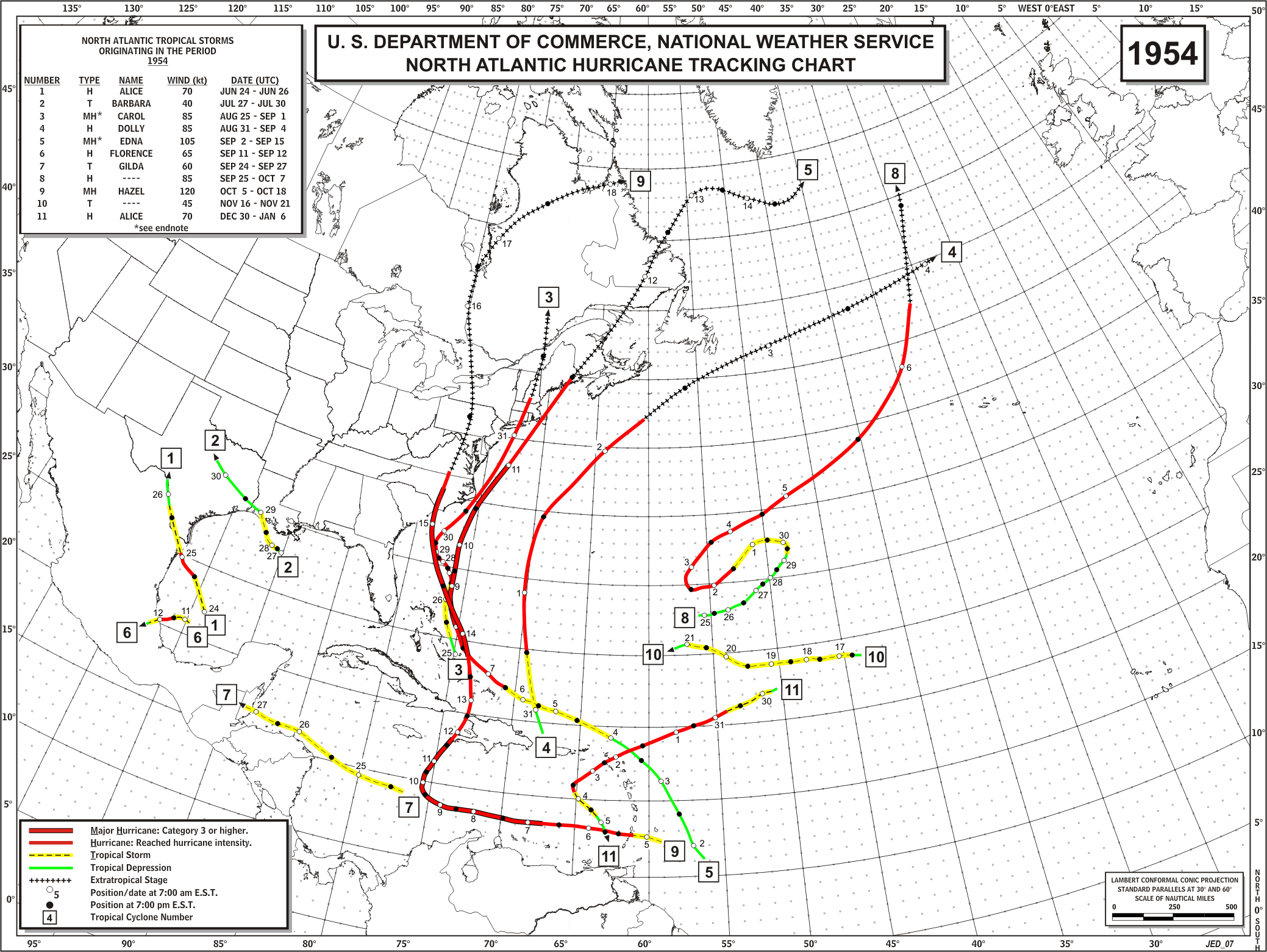
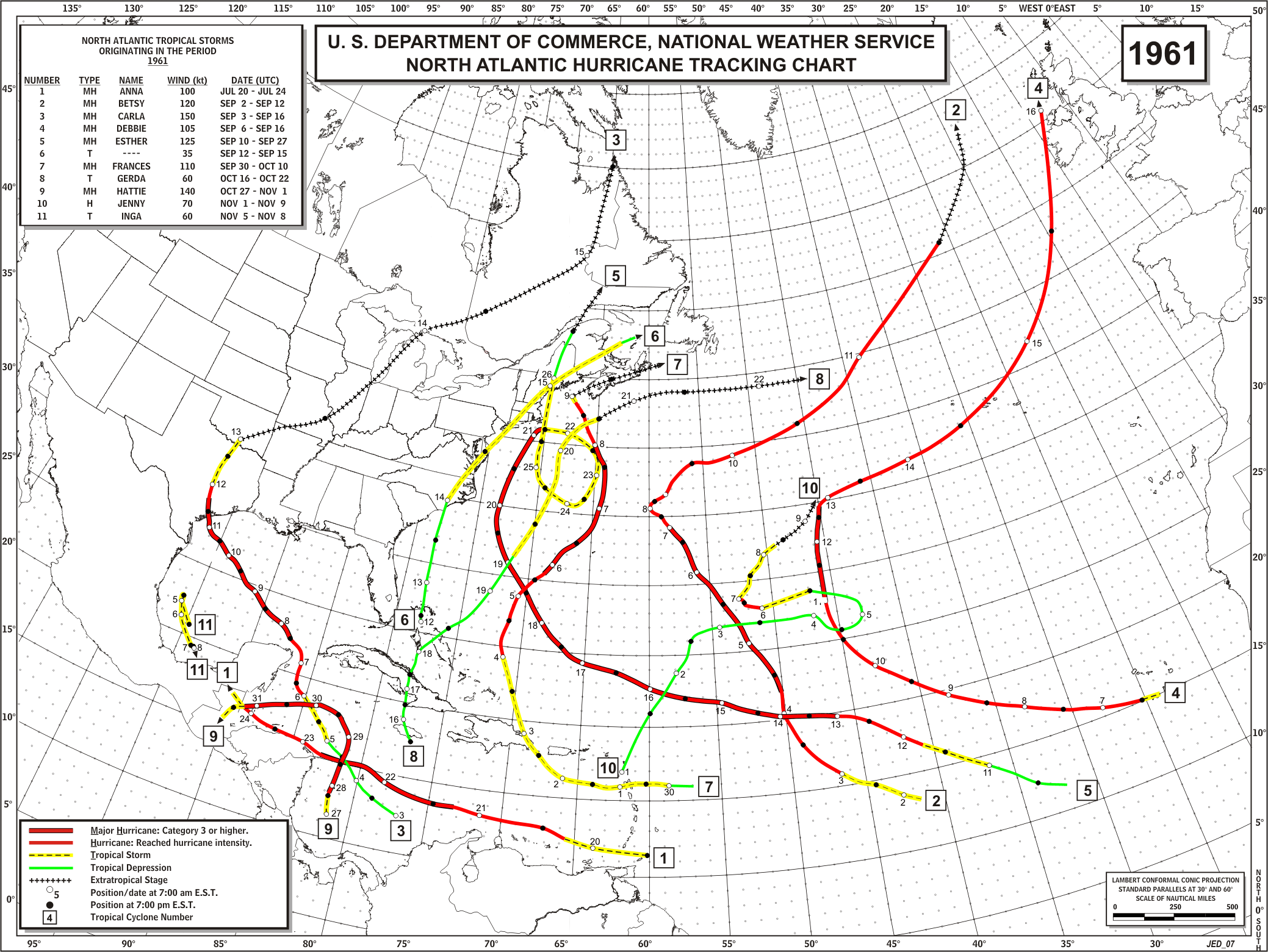
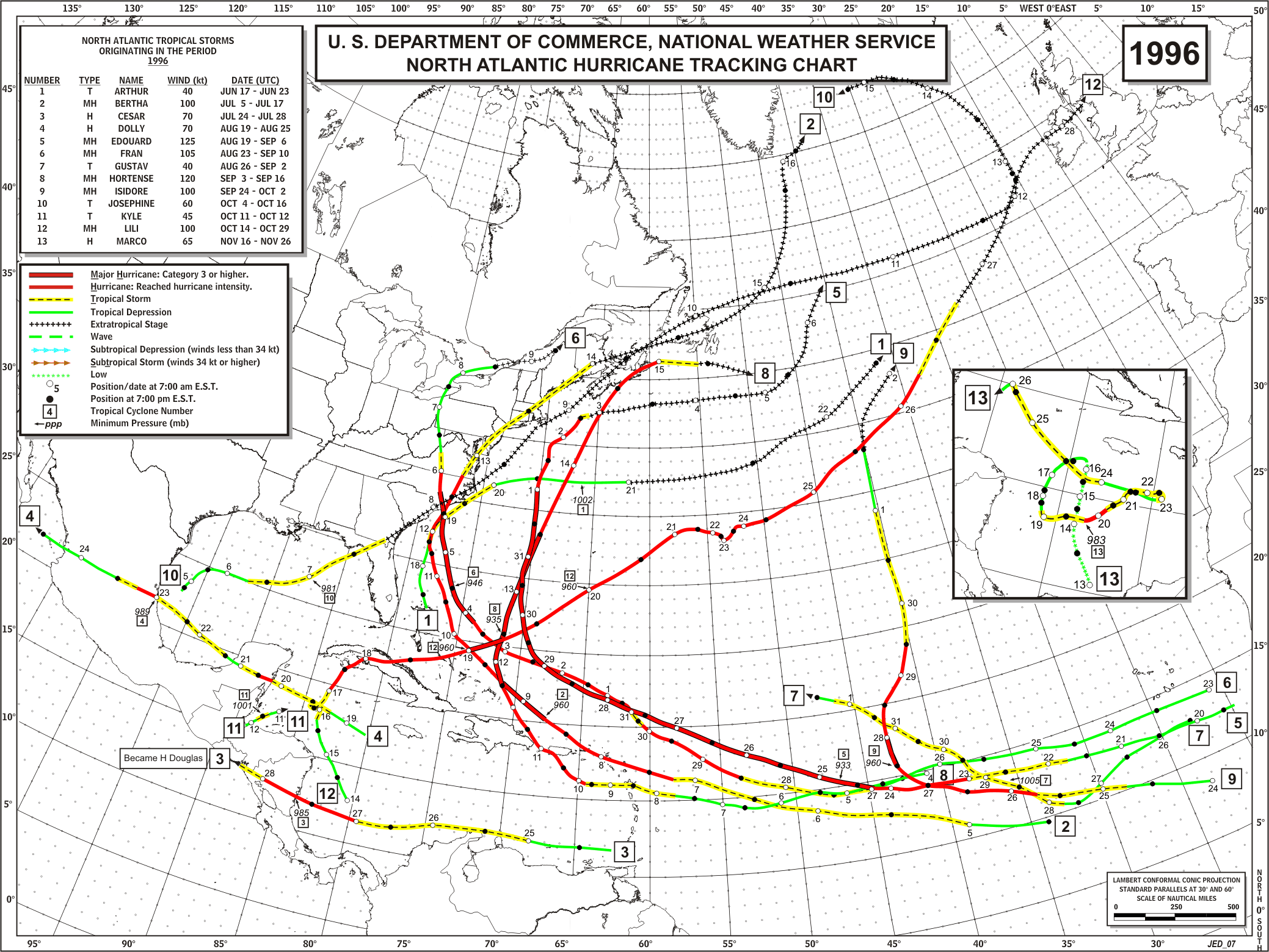
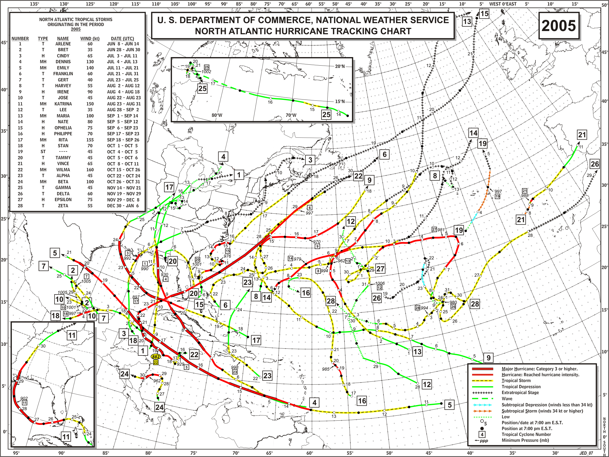
Based on historical data courtesy of Dr. Phil Klotzbach (of the CSU team with Dr. Bill Gray), since 1950 only five years in addition to 2008 have had a hurricane form in the tropical Atlantic east of 75W and south of 23.5N prior to August: 1954, 1960, 1961, 1996 and 2005.
Only four other years had a major hurricane form there prior to August: 1926, 1961, 1996, and 2005.
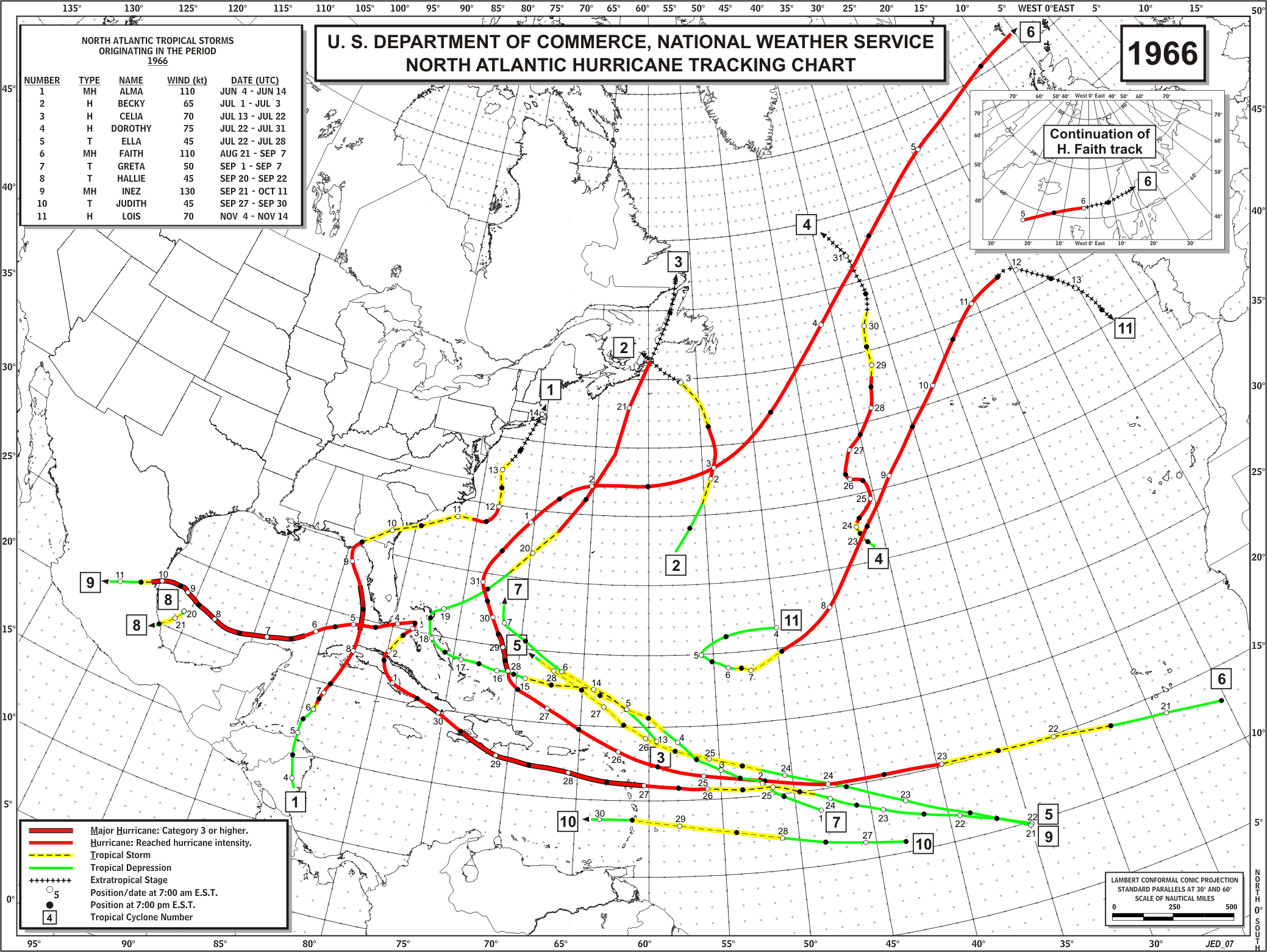
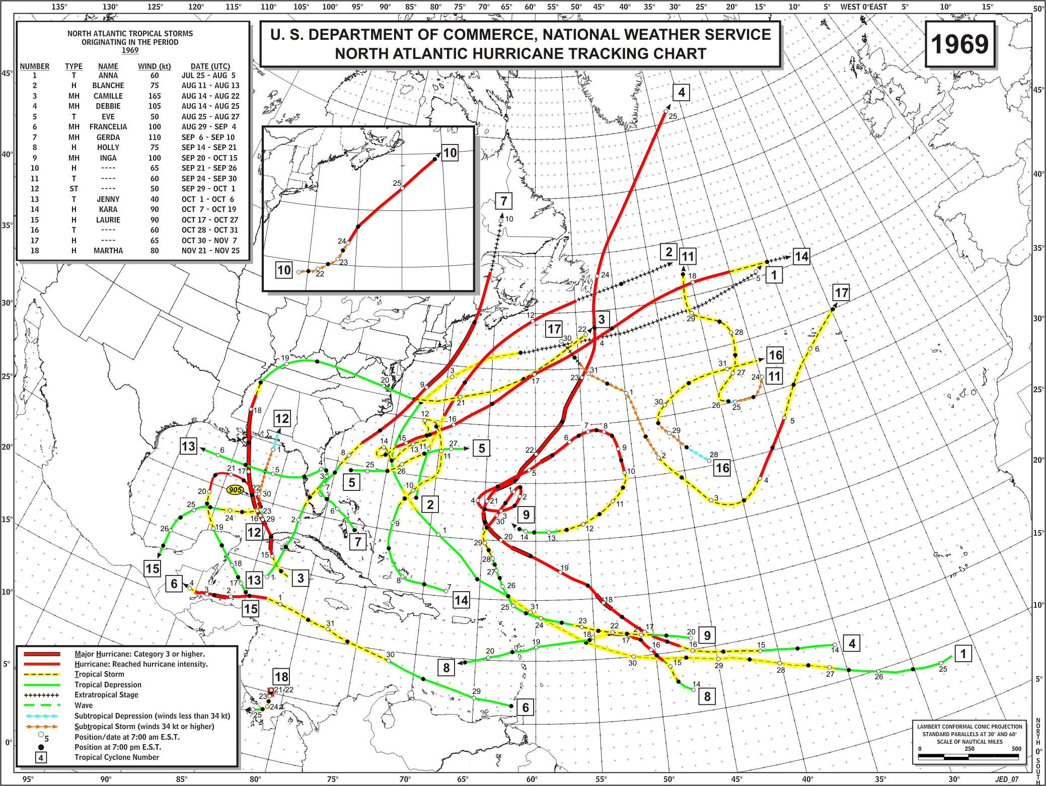
Other years with a notable amount of named storm days (NSD) in that area besides a few of the years already cited include 1966 and 1969.
All of the years listed above went on to have at least one very significant event:
1926 - The Great Miami Hurricane.
1954 - Three major hurricanes hit the East Coast of the U.S., including the legendary Hazel.
1960 - Hurricane Donna, which whacked the coast all the way from Florida to the Northeast.
1961 - Carla, a gigantic Category 4 that hit Texas.
1966 - Inez, a nasty hurricane which swept across the northern Caribbean islands, brushed South Florida, and ended up in Mexico.
1969 - Camille.
1996 - Fran, which made landfall in North Carolina shortly after that year's Bertha.
2005 - Well, we all know what happened that year.
Let's hope that the current situation changes and at the end of the season we look back and see that although July was inauspicious, the atmosphere settled down and/or the configuration of steering currents kept any significant tropical cyclones away from land ... but at the moment the character of the tropical atmosphere (the amount of convection, instability, spin, etc.) is much different than it was in July of the past two years, and is reminiscent of July during years past that did not have a good outcome.
UPDATE 3PM SATURDAY JULY 19
Still active ...
In the Pacific, Elida moved into stable air and weakened, while Fausto strengthened into a hurricane and is sending waves to the Mexican coast; the western Caribbean disturbance crossed over Central America, where it produced locally heavy rain, and has the potential to become a tropical cyclone in the eastern Pacific.
In the Atlantic, the disturbance which was northeast of Jacksonville, Florida is now closer to Jacksonville, North Carolina and has developed into Tropical Storm Cristobal as it skirts the coast.

The tropical wave in the eastern and now central Caribbean still bears watching and is still headed toward the Yucatan and Gulf of Mexico. Kingston, Jamaica today has had squalls with heavy rain and sustained winds briefly as high as 31 mph.

Bertha is still a tropical cyclone; in fact it reintensified into a hurricane.
The low in the extreme eastern Atlantic has fizzled but there's another strong disturbance over Africa that will emerge off the coast in a couple of days, and we're now heading toward the time of the year when the "Cape Verde season" typically ramps up (it got off to an early start this year with Bertha).
No comments:
Post a Comment